All projects

Latest terrain-mapping project

The Rock Airsoft terrain mapping.

A terrain-rich field-mapping project that combines current aerial imagery with contours, a player-reference grid, routes, water features, and working zone references for a large outdoor venue.

Orthomosaic mappingTerrain contextCustom map delivery
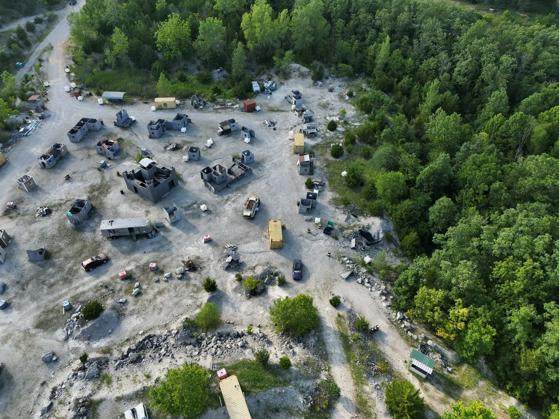
Oblique aerial view of The Rock Airsoft staging area and field structures in Bolivar, Missouri.

Oblique aerial context records the staging area, structures, access routes, and surrounding wooded terrain.

Supporting view

Project

The Rock Airsoft

Location

Bolivar, Missouri

Work

Orthomosaic, terrain, and field-map documentation

Date

July 2026

The project brief

Make the whole site easier to understand.

The finished map gives owners and reviewers a shared visual language for discussing a complex site where elevation, woods, water, roads, structures, and named areas are difficult to understand from ordinary photographs alone.

The work was structured around the reviewer and the decision, not around producing the largest possible image folder. Each selected view or map layer has a defined role in orientation, comparison, planning, or follow-up.

Delivered for review

What the package contained.

Deliverables were selected to move from site-wide context into specific review references without implying survey, engineering, diagnostic, or legal authority.

01

Current orthomosaic and aerial context imagery

02

Terrain-enhanced large-format field-map overview

03

Grid, route, water, structure, and working zone references

04

Focused map details for terrain and feature review

The visual record

Context first. Detail where it matters.

The project record moves from a broad site view into the specific overlays, comparisons, and focused references needed for review.

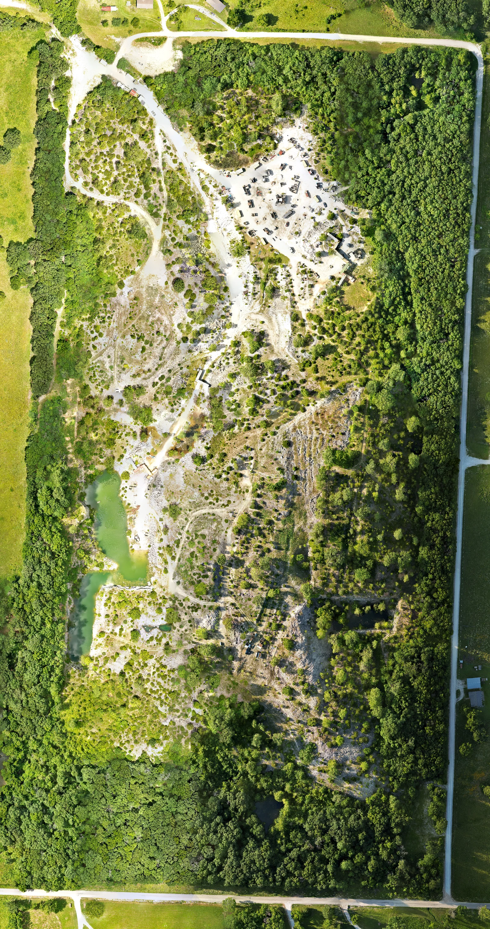
Terrain-enhanced field map for The Rock Airsoft with orthomosaic, contours, grid, zones, and map legend.
Terrain-enhanced field-map overview combining current imagery with grid, route, zone, water, and terrain references. Approximate visual reference only; not a survey.
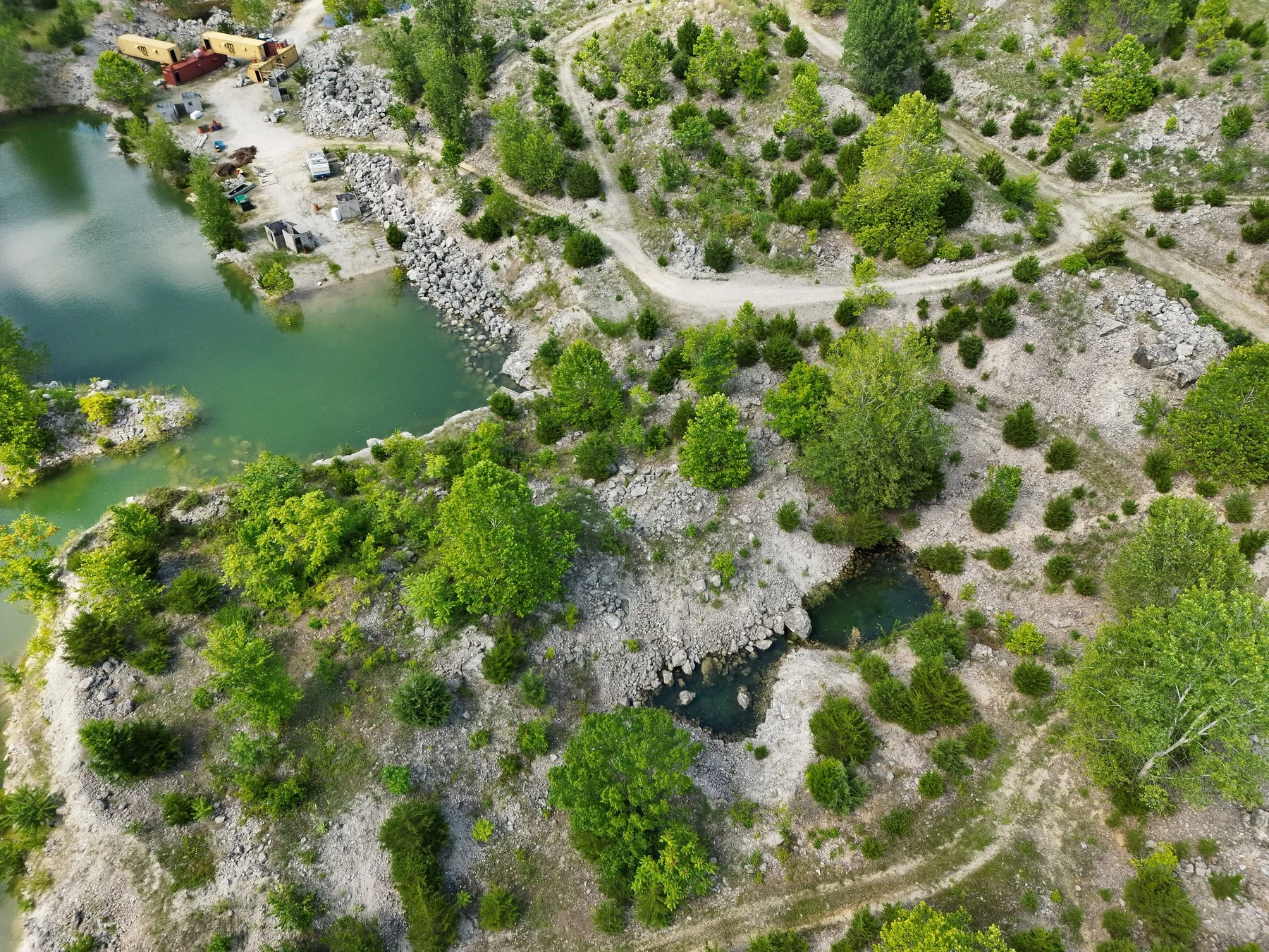
Detailed Rock Airsoft field map showing water features, contours, roads, zones, and grid references.
Detailed map crop shows how orthomosaic imagery, terrain contours, named zones, route references, and water features can be reviewed together.

Interactive field atlas

Coming soon.

The interactive field atlas is still being prepared. The static project record, imagery, deliverables, and review limits are available here now.

Capture to delivery

How the work came together.

  1. 01

    Capture the site in coordinated nadir flight blocks and process the imagery into a current orthomosaic.

  2. 02

    Organize owner-supplied boundary and feature references in GIS, keeping working, legacy, and source layers separate for review.

  3. 03

    Combine the orthomosaic with terrain, grid, route, water, structure, and zone layers in a client-review map with explicit non-survey language.

Reviewer value

What this project demonstrates.

  • 01

    Use oblique aerials to connect the map to recognizable staging areas, structures, roads, woods, and water features.

  • 02

    Layer current imagery, terrain contours, routes, zones, and a consistent grid without hiding the underlying site context.

  • 03

    Deliver a large-format review map plus focused crops that make dense terrain information easier to inspect.

Approximate mapped boundary
77.94 acres
Owner-supplied boundary reference retained as non-survey context.
Player-reference grid
98 cells
Rotated 200-foot reference cells aligned to the working boundary.
Orthomosaic delivery source
2 cm / pixel
Cropped current source used for the working map, not a survey-accuracy claim.

Evidence boundary

Useful records. Clear limits.

  • Approximate field-navigation and visual-reference product, not a survey or legal boundary
  • Owner-supplied boundaries, feature names, and working zones remain subject to owner verification
  • Terrain and imagery layers support orientation and planning; they do not replace site safety or engineering review

Public context

The Rock Airsoft official website

Public venue context for The Rock Airsoft in Bolivar, including field-use and access information.

Need a project record your team can actually use?

Send the site, decision, audience, and timing. TwoBit Aerial will recommend a capture plan and a claim-safe deliverable structure for the real project.