TL;DR / Short answer
An orthomosaic is worth it when one current overhead reference will answer the project question.
An orthomosaic map turns many overlapping drone photos into one corrected, map-style image. It is worth paying for when the buyer needs a dated overhead record that separate photos would make hard to explain.
The important question is not whether the map looks impressive. It is whether the buyer needs one file that shows the whole site, roof, work area, or property in context.
If a Bolivar church needs roof planes, parking, drainage, and access points in one board packet, a stitched map may help. If a Springfield contractor only needs a few roof-edge or equipment photos for a vendor, do not buy the bigger map package.
Treat measurements, parcel overlays, and boundary references carefully. They can help with orientation, but they are not legal survey results unless the proper licensed survey workflow is involved.
What an orthomosaic map is
An orthomosaic turns overlapping drone photos into one organized map view.
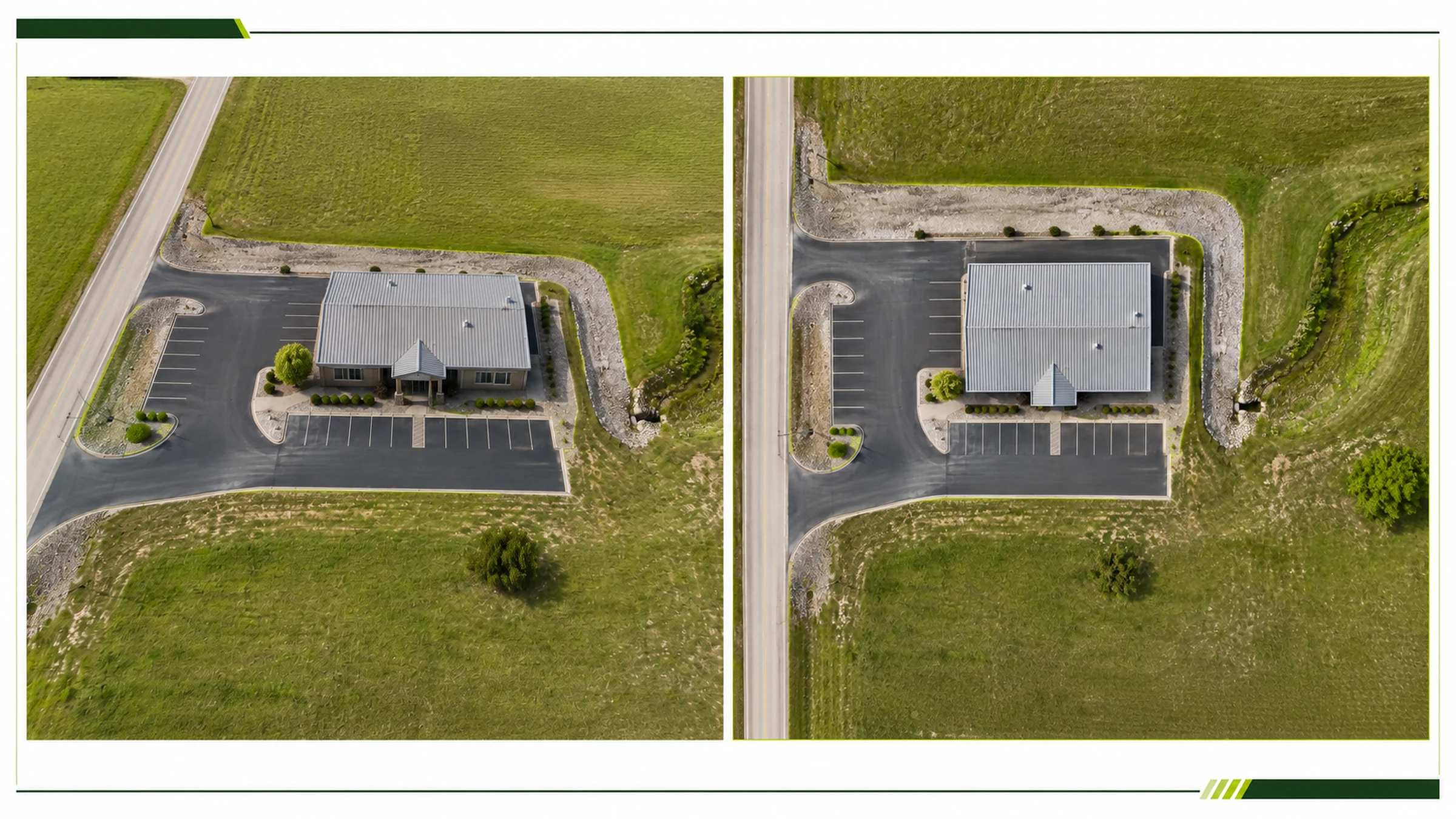
An orthomosaic map is a corrected aerial map made from many overlapping drone photos. It gives a top-down view of an entire property, roof, worksite, or outdoor area in one organized image.
A regular drone photo is still a perspective view. Camera angle, lens distortion, terrain, roof slope, shadows, and distance from the subject can all affect how objects appear.
An orthomosaic is processed so it works more like a map. The flight is planned with image overlap, then photogrammetry software matches common points, corrects distortion, and stitches the images into one continuous overhead reference.
The final map can show buildings, roof sections, pavement, drainage areas, equipment, materials, access roads, open ground, and surrounding site context in one view. It is usually newer, more detailed, and more project-specific than public map imagery.
When an orthomosaic is worth it
Use an orthomosaic when the full site matters.
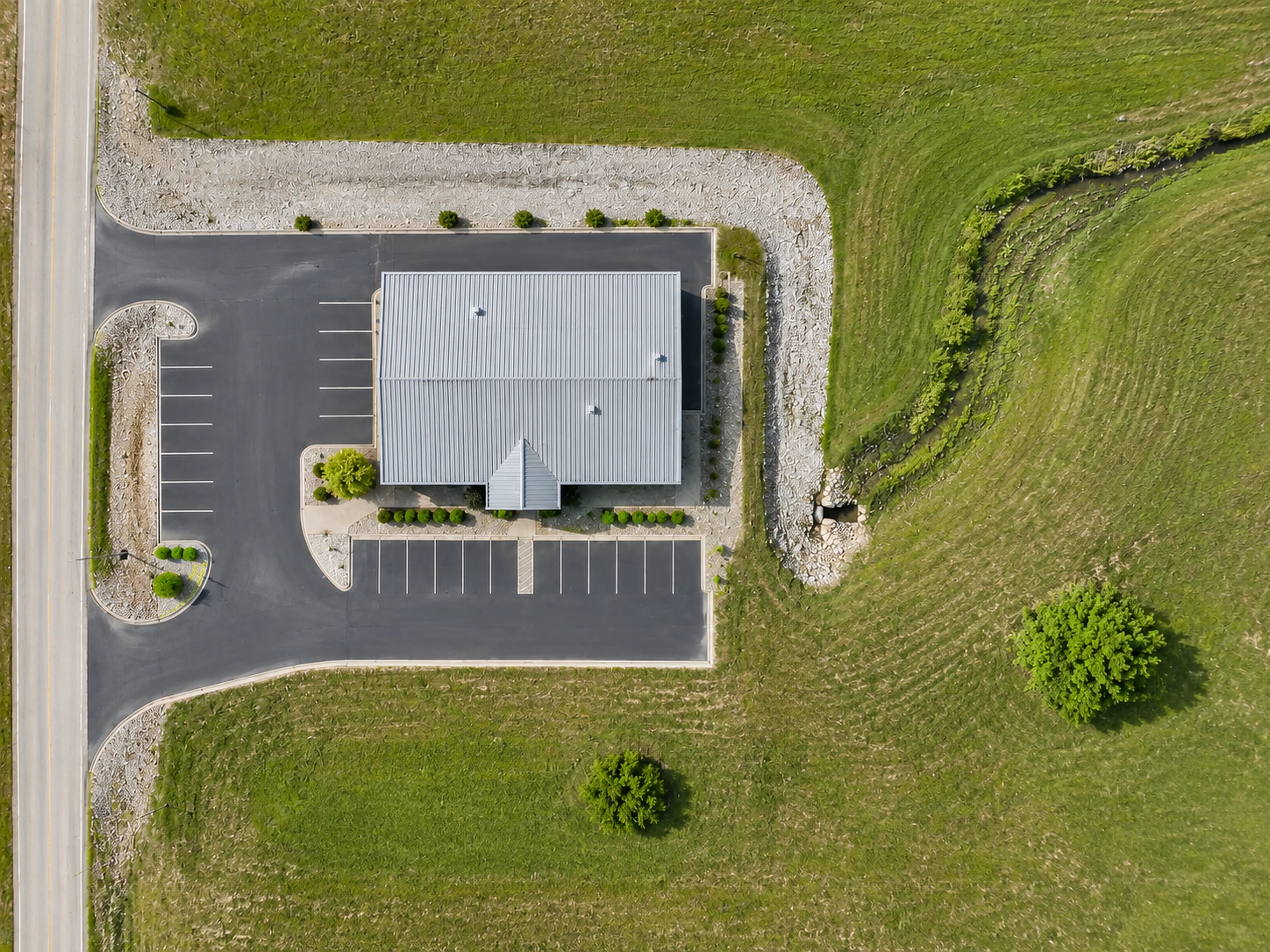
Orthomosaic maps are useful when a larger area needs to be discussed from one clear overhead record.
Good Southwest Missouri fits are usually layout problems, not photo problems.
- Bolivar ownerNeeds one current map of a gravel lot, building, drive entrance, drainage swale, and material area before talking with a contractor.
- Springfield project managerWants a dated overhead record before paving or exterior turnover so remote reviewers can see access, staging, and finished work areas.
- Rural siteNeeds a visual reference for gates, drives, ponds, outbuildings, and visible fence conditions before deciding whether a smaller photo set is enough.
When normal aerial photos may be enough
A normal aerial photo set is often the cleaner scope when the full map is not needed.
Not every job needs photogrammetry processing. Sometimes the useful deliverable is a short, organized photo set from practical viewpoints.
Normal aerial photos may be enough for a simple before-and-after record, a few roof or property overview angles, a focused exterior issue, or a quick owner update for people who already understand the site.
They can also be better when vertical details matter. Walls, fascia, gutters, roof edges, signs, towers, equipment sides, and steep surfaces often need oblique photos or close-detail views rather than only a top-down map.
If the question is "show me the north wall, the roof edge, and the loading area," start with Site Documentation. If the question is "where does every photo sit on this property," then the orthomosaic starts to make sense.
What affects orthomosaic accuracy
Measurements can be useful, but accuracy has to be planned before the flight.
An orthomosaic can often support distance, area, and layout references, but the level of accuracy depends on how the project was captured, controlled, processed, and reviewed.
For rough planning, approximate measurements may be enough. For engineering, construction layout, legal boundary work, or higher-stakes deliverables, the project needs a formal accuracy plan before capture.
The ASPRS positional accuracy standards are built around best practices and guidelines for geospatial data as methods and technologies evolve. In buyer terms: accuracy is a scoped deliverable, not a word to imply casually.
For most property records, an orthomosaic should be treated as a high-quality map image unless a specific accuracy standard has been planned, measured, and documented.
Planning reference
Approximate distance and area references can be useful for scoping, communication, and visual planning.
Higher-accuracy work
Engineering, layout, legal boundary, or high-precision deliverables need a formal accuracy plan and the right professional oversight.
Boundary overlays
Parcel lines and property overlays can help with orientation, but they should be treated as approximate unless verified by a licensed surveyor.
What an orthomosaic can and cannot prove
A map-style drone output is a planning reference unless the scope says otherwise.
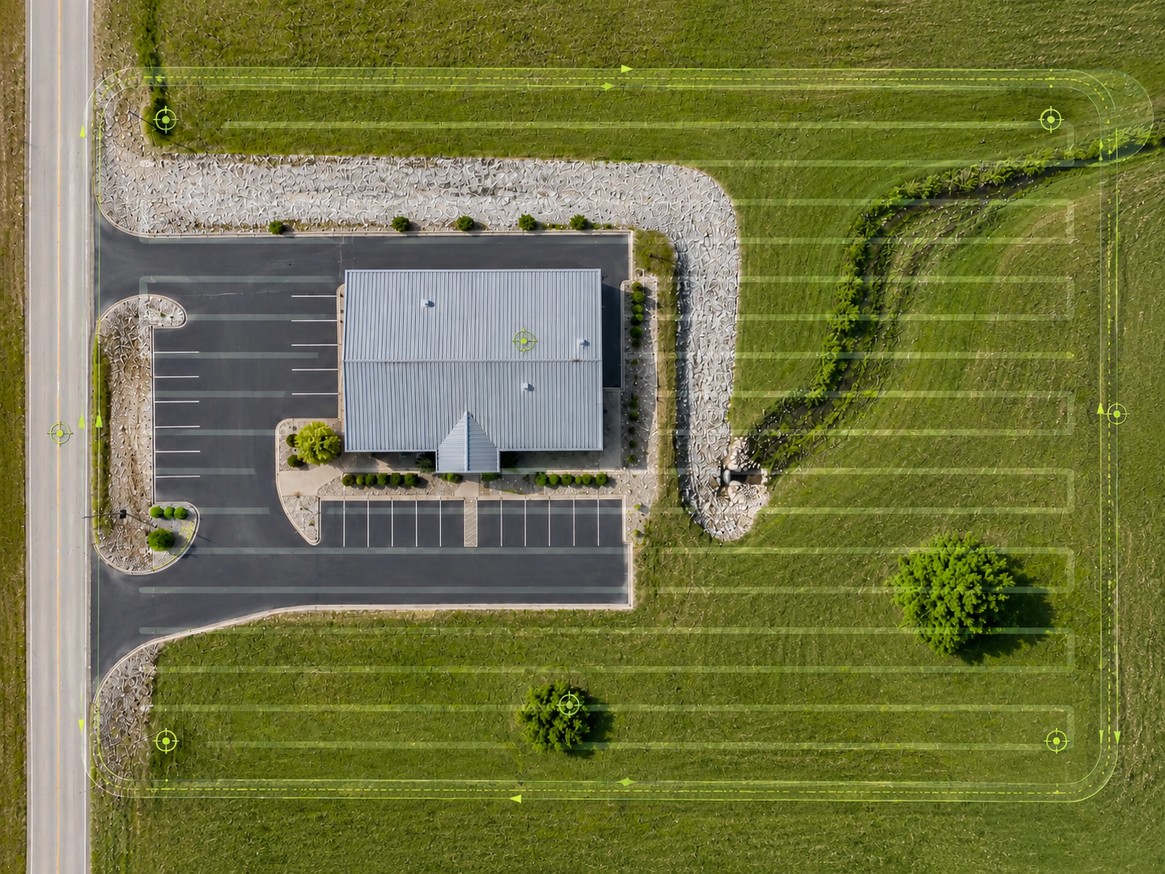
An orthomosaic can give reviewers a shared map, rough distances, dated context, and a better way to talk about the site. It cannot automatically prove legal boundaries, engineering conditions, roof conditions, insurance facts, code compliance, or hidden defects.
The map only shows what the camera can see from above. It cannot see inside a roof system, under trees, inside buildings, underground, or behind obstructions.
Parcel overlays, approximate measurements, and map-style references can help reviewers get oriented, but they should not be treated as property-line proof unless verified through the proper professional process.
Missouri's professional land surveying definition includes work tied to land boundaries, topographic surveys, elevations, maps, drawings, improvements, and real-property-rights issues. Missouri also prohibits unauthorized professional land surveying practice without the required license or certificate of authority.
For paid commercial drone work, the FAA says a remote pilot must hold a Remote Pilot Certificate under Part 107. That operating baseline is separate from survey, engineering, roofing, insurance, and code authority.
What to send before requesting an orthomosaic quote
A better quote starts with the map purpose, not just the address.
Two properties with the same acreage can require different work if one needs a simple planning reference and the other needs tighter measurement support, callouts, or recurring comparison.
Send enough context to decide whether the job needs a stitched orthomosaic, a simpler aerial photo set, or a broader site record.
A useful request sounds like this: "We need a current overhead map of the back lot, drive entrance, drainage area, and material storage before meeting with a contractor. Measurements are for rough planning only." If the map will be used for parcel overlays, drainage review, recurring comparison, or public-facing material, say that early so the capture plan and limitations can be scoped clearly.
TwoBit's Pricing and Service Area pages are useful background before reaching out, but the actual quote depends on the site, timing, access, travel, airspace, processing, and deliverable expectations.
What you receive
The right deliverable depends on the purpose.
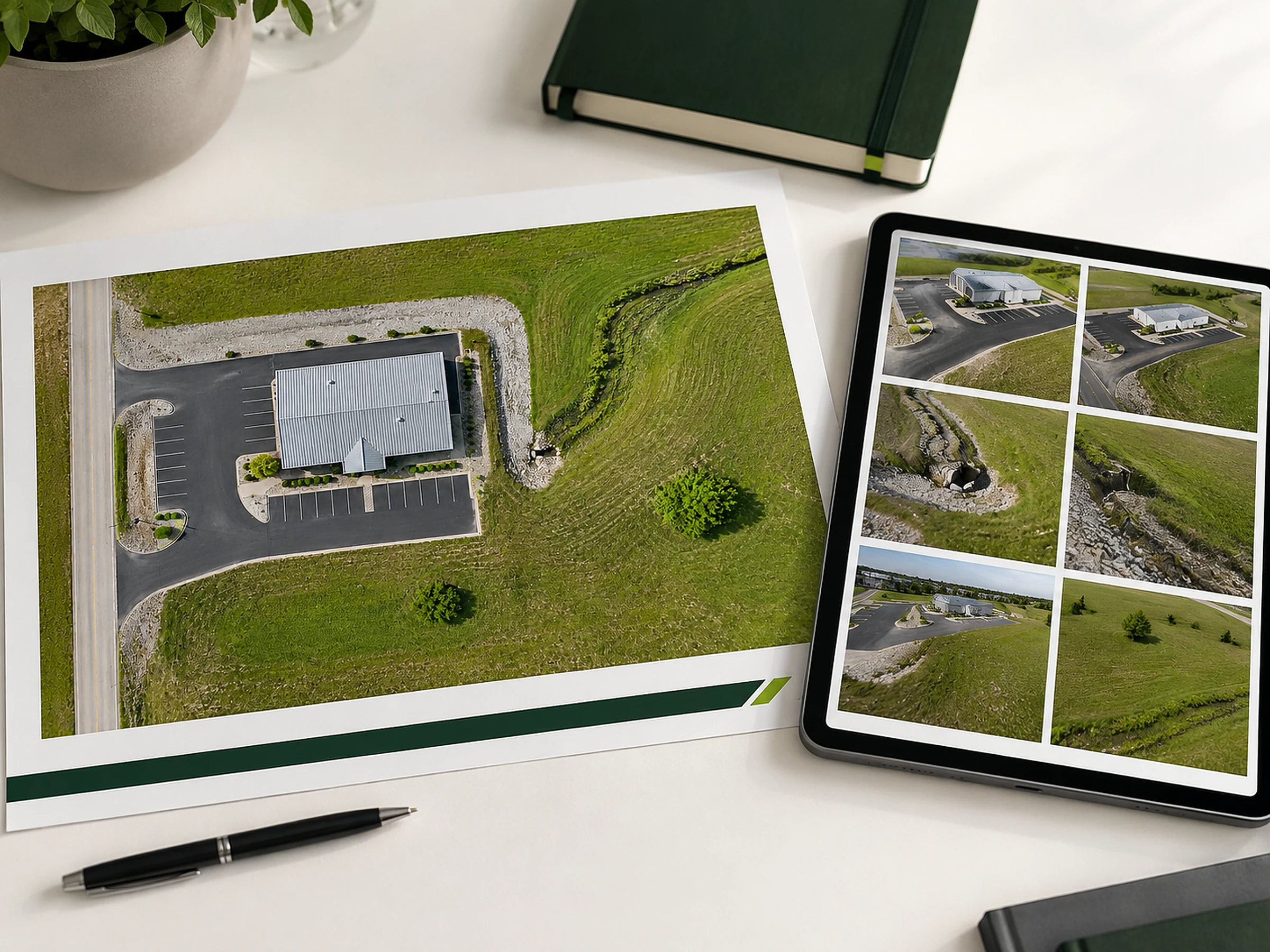
Deliverables can vary depending on the project. A property owner may only need a clean PDF map. A contractor may need a marked-up progress record. A planning or GIS reviewer may need georeferenced files that can be used with other site data.
High-resolution map image
A clean, top-down view of the documented area.
PDF site map or report
A review-friendly document for owners, contractors, or stakeholders.
Areas of interest
Optional callouts that help point reviewers to visible locations or site conditions.
Supporting photos
Aerial images that provide detail where the top-down map is not enough.
Google Maps and other public map platforms are useful, but they may be outdated, lower resolution, or captured at a time that does not reflect current site conditions.
A drone orthomosaic is project-specific. It records the property as it exists now, at the level of detail needed for the job. That makes it useful when a current capture set matters more than a general public map.
Bottom line
Buy the orthomosaic when the map view will actually change the decision.
An orthomosaic is not a better version of every drone photo. It is a specific deliverable for site-wide context, comparison, owner updates, and map-style delivery.
If the project team needs one current overhead reference, a map-style deliverable can make the discussion clearer. If the buyer only needs three useful views, keep the scope smaller.
The important boundary is accuracy. Orthomosaic maps can support rough comparison, owner packets, contractor conversations, and site records, but legal boundaries and higher-stakes measurements require the proper professional process.
To scope the real job, send the site location, map purpose, approximate area, delivery needs, access constraints, and whether measurements are approximate or higher-stakes.
If your property, worksite, roof, or outdoor area needs a current overhead record, the next step is to define the map purpose, coverage area, deliverables, and accuracy expectations.
Ask About Orthomosaic MappingFAQ
Orthomosaic map questions buyers usually need answered first.
These answers keep the deliverable useful without overstating what a drone map can prove.
1. What is an orthomosaic map?
An orthomosaic map is a top-down map-style image made from many overlapping aerial photos that have been processed, corrected, and stitched together into one organized view.
2. When is an orthomosaic map useful?
It is useful when a property, roof, worksite, or outdoor area needs one current overhead reference for layout decisions, owner updates, progress comparison, or site records.
3. Is an orthomosaic better than normal drone photos?
Not always. An orthomosaic is better when the full layout matters. Normal aerial photos may be enough when the buyer only needs a few angles, close visual context, or a simple before-and-after record.
4. Can an orthomosaic map be used for measurements?
It can support approximate distance, area, and layout references when the scope allows it, but the useful accuracy depends on flight planning, overlap, control methods, processing, terrain, and whether the project was designed for measurement use.
5. Can an orthomosaic replace a legal survey?
No. Orthomosaic maps can support project records, layout conversations, and rough orientation, but they should not be treated as legal boundary surveys unless the proper licensed survey workflow is involved.
6. What affects orthomosaic accuracy?
Accuracy can be affected by flight height, image overlap, camera quality, lighting, terrain, surface texture, processing settings, RTK or PPK use, ground control points, checkpoints, and licensed survey review where needed.
7. What should I send before requesting an orthomosaic quote?
Send the location, approximate area or acreage, purpose of the map, desired timing, delivery format, overlay or callout needs, measurement expectations, access constraints, and any existing plans, maps, or photos.
Sources and reference basis
Where the guidance comes from
This guide combines TwoBit Aerial's public mapping service boundaries with external operating and mapping-accuracy references. It is written for buyer understanding, not as survey, engineering, or legal boundary guidance.
- FAA Remote Pilot Certificate
Used for the commercial small UAS operating baseline and remote-pilot framing.
- ASPRS positional accuracy standards
Used as the reference point for why mapping accuracy must be scoped instead of implied.
- Missouri professional land surveying definition
Used for the article's Missouri boundary, real-property-rights, and survey-practice cautions.
- Missouri unauthorized professional land surveying practice prohibition
Used to explain why legal survey language should stay outside normal drone mapping deliverables.
- TwoBit Aerial orthomosaic service page
Used to keep this article aligned with the public offer and claim boundaries.
- TwoBit Aerial pricing
Used for the quote-prep path and scope factors.
- TwoBit Aerial service area
Used for the local Missouri service-fit path.