Commercial inspection support

Drone inspection support for roofs, properties, and commercial assets.

For owners, roofing teams, contractors, facility managers, and documentation reviewers who need practical aerial visibility before qualified follow-up.

FAA Part 10730-45 min includedQuoted by scope
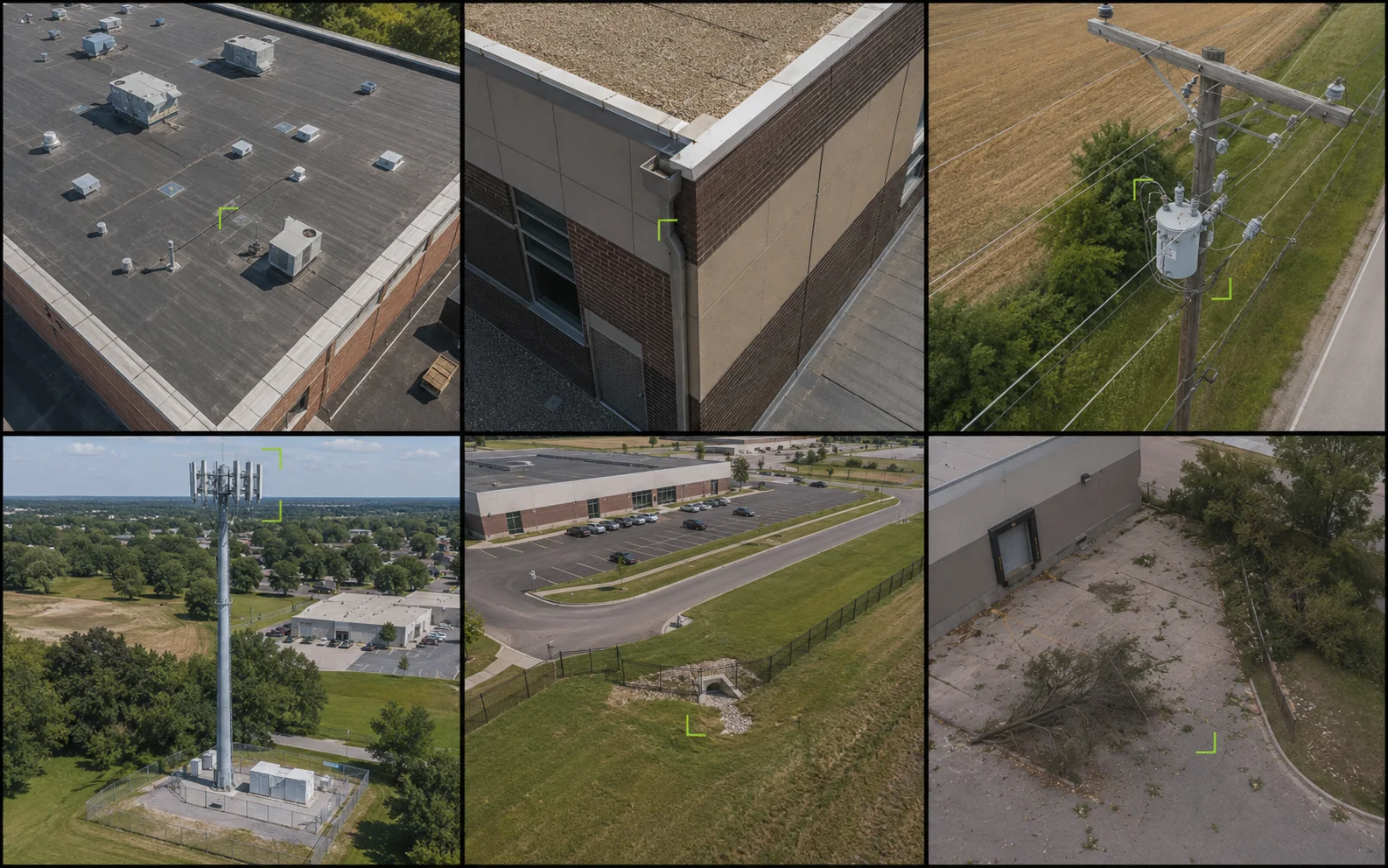
Illustrative six-panel aerial inspection montage showing commercial roof, building exterior, utility pole, communications tower, property context, and post-event documentation views.
Inspection coverageIllustrative service visualInspection capability overview

Service brief

Purpose / audience / scope

The service at a glance.

01

What it is for

Inspection services are built around usable visual records: clear overview imagery, detail references, and organized delivery that helps teams review hard-to-see areas before deciding what follow-up is needed.

  • Roof and exterior documentation from safer vantage points
  • Property and site visibility for planning conversations
  • Post-storm or post-event visual records
  • Pre-project and post-project reference imagery
02

Who uses it

Best fit for teams that need safer visual access, clearer context, or a review-ready documentation package.

  • Commercial property owners and managers
  • Roofing companies
  • Documentation reviewers
  • General contractors
  • Facility and asset teams
03

What is included

The scope is shaped around practical records, clear review needs, and the agreed deliverable package.

  • Capture planning based on the property and deliverable needs
  • Aerial image collection with useful overview and detail coverage
  • Commercial-first file structure that supports internal review, vendor coordination, or follow-up planning

Deliverables

Inspection records built for the next conversation.

Overview, detail, callout, and delivery structure stay connected so the reviewer can move from context to a focused next step.

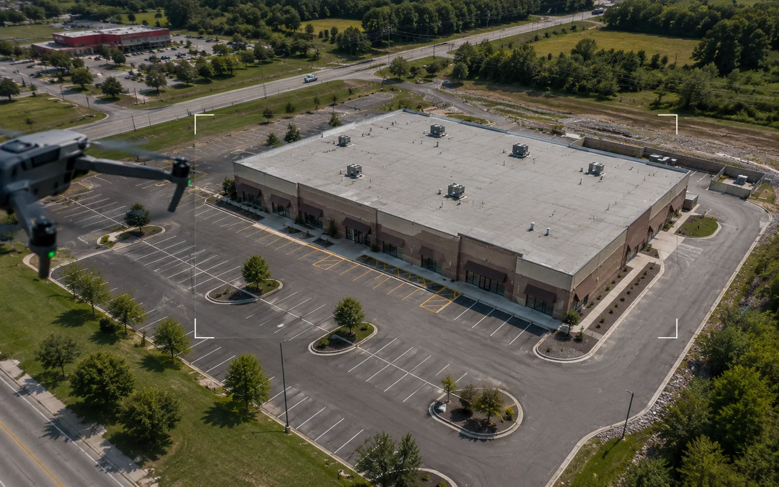
Illustrative scene of a drone capturing an overview image set of a commercial property, including the roof, parking areas, access lanes, and exterior context.
Overview captureIllustrative service visual

High-resolution overview image sets

Capture planning based on the property and deliverable needs

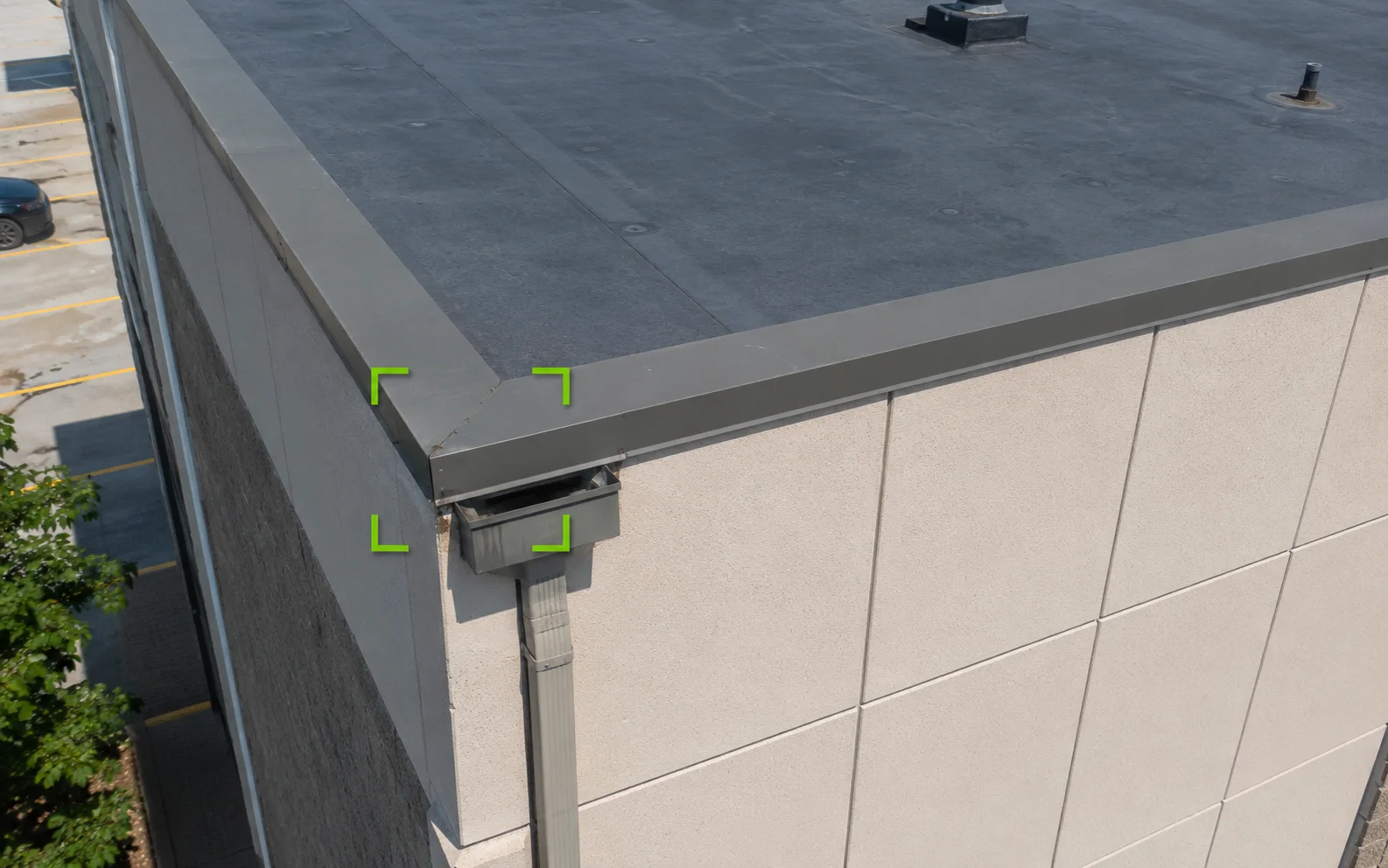
Illustrative close aerial detail view of a commercial roof edge, parapet cap, wall panels, and downspout area marked for follow-up review.
Detail referenceIllustrative service visual

Detail reference images

Aerial image collection with useful overview and detail coverage

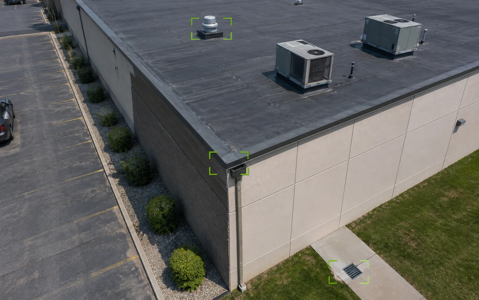
Illustrative aerial inspection view of a commercial building with subtle callouts around a rooftop feature, roof-edge drainage area, and site-access detail.
Review calloutsIllustrative service visual

Optional annotated callout selections

Commercial-first file structure that supports internal review, vendor coordination, or follow-up planning

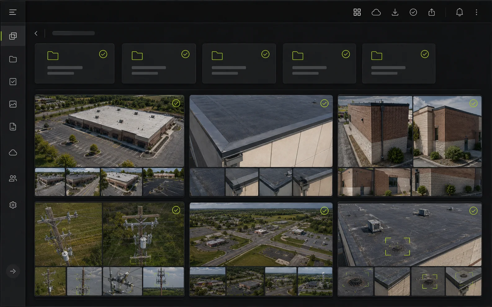
Illustrative organized digital inspection delivery view with grouped aerial thumbnails, callout references, and file structure for follow-up review.
Delivery structureIllustrative service visual

Organized delivery notes and file structure

Capture planning based on the property and deliverable needs

Representative deliverable preview

See what the package can contain.

Preview only. Final page count, file types, notes, and source imagery are shaped around the actual site, audience, and review goal.

01PDF summary
02Overview set
03Detail references
04Callout index
Inspection documentation / 01Inspection documentation portfolio
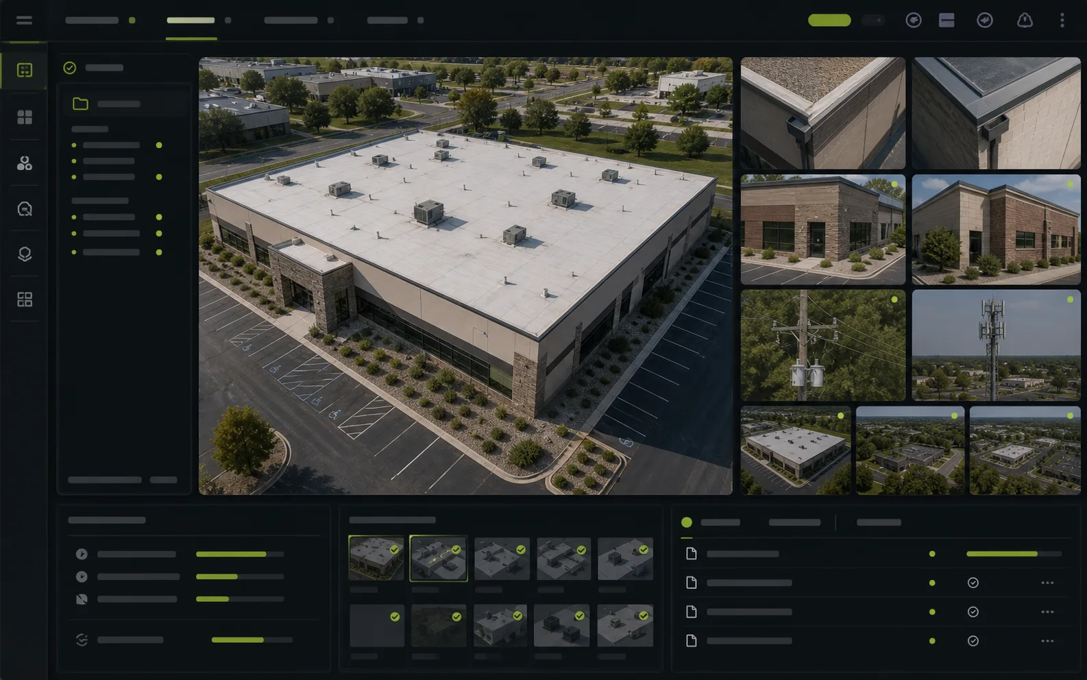
Illustrative representative drone inspection package preview showing a commercial property image, detail thumbnails, callout references, and organized review sections.
Preview packageIllustrative service visual

A broad inspection-support package keeps site context, selected details, callouts, and review notes connected.

Package index

  1. 01Site orientationWide views establish the property, asset, and access context.
  2. 02Selected detailsCloser references preserve visible features for follow-up review.
  3. 03Callout registerLabels connect selected details back to their wider location.
  4. 04Delivery notesFile structure, limits, and intended review use stay visible.
Delivery shapeFinal contents follow the agreed scope.
  • Organized image groups
  • Optional callout pages
  • Documentation limits retained

Scope, area, and pricing

Quoted around the actual site.

TwoBit Aerial is based in Bolivar, Missouri. Pricing includes travel for most jobs within 30-45 minutes of Bolivar, Missouri. Jobs farther out may include a travel charge based on distance, drive time, and scope.

Service area

TwoBit Aerial is based in Bolivar, Missouri. Pricing includes travel for most jobs within 30-45 minutes of Bolivar, Missouri. Jobs farther out may include a travel charge based on distance, drive time, and scope.

  • Most straightforward local jobs fall inside the included travel range used by the published pricing.
  • Distance, drive time, and scope determine whether additional travel needs to be added.
  • Larger commercial, recurring, or multi-site scopes can still be priced cleanly without a rigid public fee table.

Pricing approach

Straightforward roof and property documentation can support starting-at pricing, while more complex infrastructure scopes are typically quote-based.

  • Focused service pages show starting prices where a public baseline is useful.

Inspection documentation workflow

From review question to organized visual record.

  1. 01Scope

    Scope and site review

    Confirm the property, the areas to capture, and the purpose of the documentation before flight planning begins.

  2. 02Capture

    Flight planning and capture

    Capture the site from efficient, repeatable vantage points with attention to clarity, context, and safe access.

  3. 03Review

    Organization and review

    Sort imagery into a usable structure so the output is easy for owners, managers, and vendors to review.

  4. 04Deliver

    Delivery

    Send a clean package of labeled files and any agreed visual callouts or summary notes.

Local. Professional. Claim-safe.

Clear visibility without inflated conclusions.

TwoBit Aerial keeps public deliverables framed as documentation, screening, planning support, and reference material.

FAA Part 107

Commercial operations start from a Part 107 baseline.

Documentation support

Overview, detail, and callout imagery support review without replacing a qualified hands-on inspection.

Context before detail

Selected close references remain connected to the wider property or asset so reviewers can orient quickly.

No technical determination

Imagery does not provide engineering, roofing, structural, utility, code, appraisal, or compliance conclusions.

Scope-dependent quotes

Final pricing depends on site size, access, travel, timing, and requested deliverables.

FAQ

Common questions before quoting.

Can drone inspection imagery replace a hands-on inspection?

No. Drone inspection imagery improves visibility and creates useful documentation, but it does not replace qualified roofing, engineering, insurance, or hands-on inspection decisions.

What should I send before requesting a drone inspection quote?

Send the property location, the structure or asset that needs documentation, the reason for the inspection, timing, and any known access or safety constraints.

What do drone inspection deliverables usually include?

Most inspection scopes include organized aerial images, overview and detail perspectives, and optional callout images when they help the buyer or vendor review the site.

Send the project details.

Share the location, deliverable goal, timing, and any existing photos or plans. TwoBit Aerial will shape the scope around the actual property or project.